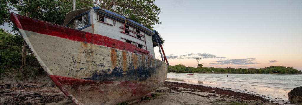
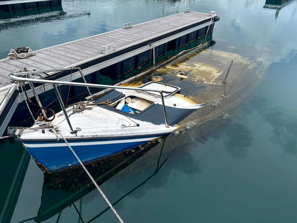
Abandoned & Derelict Vessels (ADV)
With funding from the National Oceanic and Atmospheric Administration (NOAA) Marine Debris Program, we are offering a nationwide ADV Program for the removal and prevention of abandoned and derelict vessels.
About the Grant
BoatUS Foundation’s ADV Grant Program
The BoatUS Foundation has been awarded a $10 million grant from the National Oceanic and Atmospheric Association Marine Debris Program to administer a national competitive grant program for the removal of abandoned and derelict vessels (ADVs). The project components also include the development of a national database to track ADVs, outreach and education on the topics of ADVs and a national conference centered on exploring existing and emerging technologies and best practices for responsible and sustainable disposal of boating-related waste streams.
BoatUS Foundation is excited to be involved in this groundbreaking project. This is a new process for both BoatUS Foundation and the NOAA Marine Debris Program. We are working diligently to complete all components of the program. See below to learn more information about the program.
This project is supported by the National Oceanic and Atmospheric Administration Marine Debris Program.
Grant Funding for ADV Removal
The awarded states, communities, organizations and programs include:
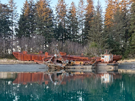
City & Borough of Yakutat, Alaska
Located on the northeastern corner of the Gulf of Alaska inside Tongass National Forest near the Canadian border, Yakutat features a variety of remote, flat, and sandy beaches that characterize this part of Alaska, often called “The Lost Coast.” The city and borough’s location on the Gulf of Alaska, combined with the geography of the area, positions Yakutat’s shores as a natural collection point for large quantities of marine debris carried by powerful ocean currents and weather patterns. City officials; tribes; other local, state, and federal organizations and agencies; and individuals regularly work together to remove this marine debris. However, the community’s remote location and lack of roads and rail make large-scale disposal challenging.
Yakutat plans to remove seven abandoned and derelict vessels (ADVs) across three locations to make way for an extensive harbor expansion and upgrade project, creating local jobs and supporting a seafood industry that ships products worldwide.
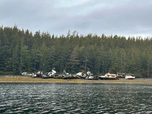
Metlakatla Indian Community, Alaska
The Metlakatla Indian Community (MIC) Annette Islands Reserve (AIR) lies in the southernmost portion of the Alexander Archipelago in southeast Alaska. AIR encompasses 86,313 acres of land and 46,019 acres of water – 136 square miles – and is only accessible by small aircraft or boat.
MIC’s funding will remove 27 ADVs located in Port Chester in Nicholas Passage as well as in the tribal community of Metlakatla, the state’s only Native American reservation. Removing the ADVs will improve marine habitats, make the area more attractive to tourists, and open valuable space at the docks for vessels used for commercial, recreational, and subsistence purposes.
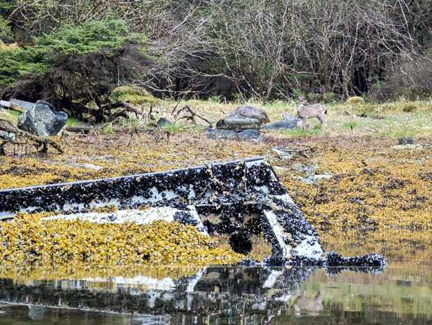
Sitka Conservation Society, Alaska
The Lisianski Inlet on the northwest part of Chichagof Island is located within the Tongass National Forest of southeast Alaska and is adjacent to the City of Pelican. The spectacular body of water is roughly 24 miles long and is surrounded by snow-capped mountains and dense temperate rainforests.
The Sitka Conservation Society’s plans include removing at least seven ADVs located on state-managed tidelands and shorelands as well as tidelands, harbor facilities, and land owned and managed by Pelican. The project will benefit the habitats used for commercial, sport, and subsistence fishing, as well as attract more global visitors for small-boat tourism.
Port Authority of Guam Harbor, Guam
Guam, the westernmost territory of the U.S., possesses the Micronesian region’s only deepwater seaport. Jose D. Leon Guerrero Commercial Port is a commerce lifeline, especially for the large U.S. military presence on this largest island in the Mariana Islands Archipelago in the Pacific Ocean.
The Port Authority of Guam anticipates removing 13 ADVs from its waterways as part of a larger plan to modernize the port. Eliminating this wreckage will help the local fishing and ecotourism industries. It will also pave the way for establishing rules and regulations for commercial and private vessel owners to create a more responsible boating environment.
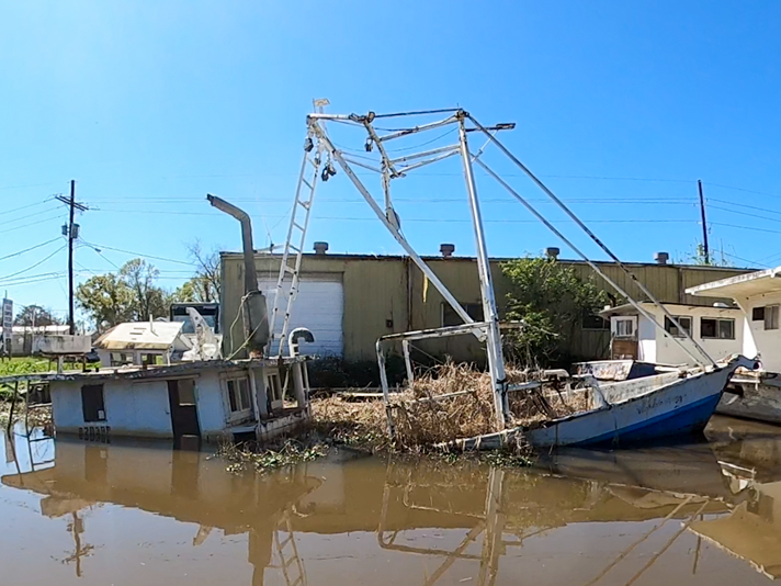
Terrebonne Parish Consolidated Government, Louisiana
The Barataria-Terrebonne National Estuary is located in the Terrebonne Basin, 55 miles west of New Orleans and bordered by the Gulf of America to the south. This biologically rich and productive ecosystem encompasses 4.1 million acres of upland forests, swamps, marshes, bayous, bays, and barrier islands and contains some of the world’s most diverse and fertile habitats.
The Terrebonne Parish Consolidated Government has an ambitious plan to remove more than 150 ADVs. Clearing these waterways improves access for commercial and recreational fishing, boating, and tourism activities like swamp tours and bird watching.
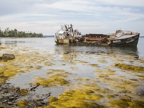
State of Maine, Department of Agriculture, Conservation & Forestry, Bureau of Parks & Lands
Maine’s natural resources agencies are collaborating to complete removals along the state’s 3,500-mile coastline. Specifically, these projects will take place in the Mid-coast (home to most of the state’s commercial fishing fleet), Central (Penobscot River, the largest river system in New England), and Downeast (Roque Bluffs State Park) regions.
Together, the agencies will remove five of Maine’s largest ADVs and other wreckage. One project, located in the Penobscot River near Bangor, sits 14 miles downstream of the Penobscot Nation’s Indian Island Reservation. The river continues to be central to the cultural and spiritual identity for these earliest inhabitants of Eastern Maine. In addition, because the state’s economy is largely defined by its fishing and lobstering industries, the removals will help make navigation safer for the fishing fleet.
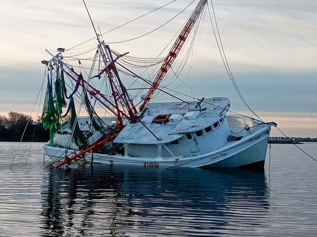
North Carolina Coastal Federation, North Carolina
North Carolina has more than 10,000 linear miles of estuarine shorelines and 2.4 million acres of marine and estuarine waters. The nonprofit North Carolina Coastal Federation is composed of federal and state agencies, local governments, universities, fishing communities, businesses, and volunteers. It has a 42-year track record of successfully protecting and restoring coastal habitats and water quality. It acquires land and conservation easements; restores wetlands, riparian shorelines, and oyster reefs; installs stormwater reduction measures; and removes marine debris, including ADVs.
The Federation will remove at least 12 abandoned ADVs in Hyde, Carteret, and Onslow counties. It plans to target publicly owned working harbors and waterfronts/commercial fishing communities burdened with concentrations of large, old, and unused commercial fishing vessels. Removing these boats will help support North Carolina’s commercial fishing communities, which are principal contributors to the state’s economy.
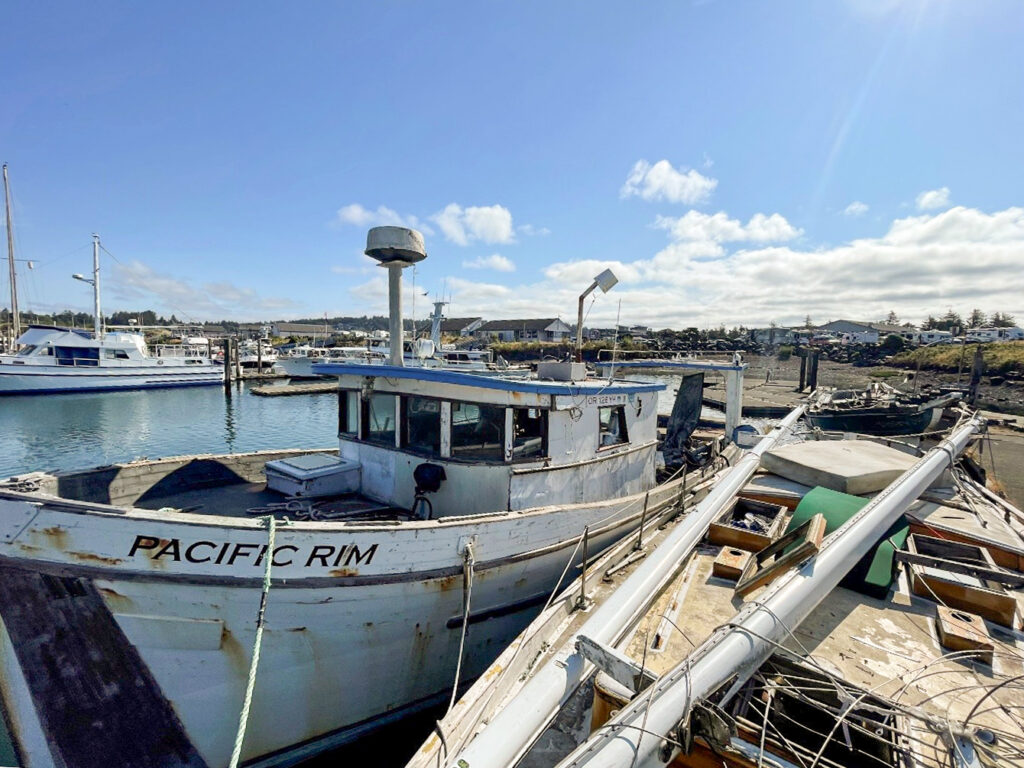
Oregon Department of State Lands, Oregon
Oregon’s 23 public ports provide recreational, commercial, and economic services to residents and businesses in Oregon and beyond. They are a key component in sustaining Oregon’s economy and quality of life, supporting thousands of family wage jobs. One out of six Oregon jobs is directly or indirectly tied to cargo, recreation, industrial, commercial, or other activities at Oregon’s ports.
The funds will allow removal of more than 40 ADVs from mooring facilities located on rivers and bays along the entire length of Oregon’s 362-mile coastline as well as on the Columbia River, which forms much of the northern border between Oregon and Washington. The ADVs inhibit the ports’ ability to provide mandated services to their communities and the state. Removal will benefit those who depend on waterways for navigation, fishing, recreation, commerce, and cultural practices.
Virgin Islands Department of Planning and Natural Resources, U.S. Virgin Islands
The St. Thomas East End Reserves, or STEER, comprises three main marine reserves and wildlife sanctuaries that hold ecologically and culturally significant coastal, marine, and fisheries resources including 9.6 square kilometers (around 2,400 acres) of mangrove forests, salt ponds, lagoons, reefs, and cays.
The Department of Planning and Natural Resources is the regulating agency of the U.S. Virgin Islands for fishing, moorings, anchoring, cruising, boat registration, coastal zone activities, boating safety and educational outreach, enforcement of regulations, and more. It plans to remove some 39 ADVs to create a better environment for endangered animals as well as those central to the fishing community, and create a safer environment for the boating community and a safe haven for boats during storms.
Makah Indian Tribe of the Makah Indian Reservation, Washington
The Port of Neah Bay is owned and operated by the federally recognized Makah Tribe of Indians. The small coastal seaport on the Makah Indian Reservation is located on the northwestern tip of the Olympic Peninsula. The reservation covers 30,049 acres adjacent to the Strait of Juan de Fuca on its northern boundary, the Pacific Ocean to the west, and Olympic National Forest to the south.
The proposed project builds on the success of previous cleanup projects to remove at least 10 vessels and other marine debris from Makah Marina. In addition to eliminating the threat of pollution posed by hazardous materials, the removals will free up boat slips to be used by the Makah fishing fleet or for fishing tourism, supporting the local economy.
Abandoned & Derelict Vessel (ADV) National Database
In 2023, The BoatUS Foundation for Boating Safety and Clean Water was awarded a grant from the National Oceanic and Atmospheric Association Marine Debris Program for the removal of abandoned and derelict vessels (ADVs). The project components also include the development of a national database to track ADVs in the United States, U.S. Territories and Freely Associated States.
The BoatUS Foundation, utilizing MyCoast as the platform, created this database to provide a place for organizations and the public to report ADVs, which helps identify problem areas and quantify the scope, and track prevention and removal efforts, etc. By reporting and tracking ADVs on a national scale, we’re hopeful the database will help to better understand the issue, work with states and communities to address it, and track efforts being made with the intention of providing solutions. Benefits of the data includes:
Informing the public: Tracking ADVs can enhance public awareness about the problem and encourage responsible boating practices to prevent the occurrence of ADVs.
Addressing environmental hazards: ADVs can pose navigation, safety, and pollution hazards to communities and the environment. Tracking helps in assessing the impact of ADVs and determining the need for action.
Preventing the spread of ADVs: By identifying and tracking ADVs, authorities can take proactive measures to prevent the introduction of new ADVs into waterways and marine environments.
Supporting removal efforts: Information on ADVs can assist in planning and executing removal efforts, which may involve specialized equipment and resources.
Facilitating collaboration: Tracking ADVs can facilitate collaboration among various agencies and stakeholders to address the problem effectively.
If you are with an organization or government agency who would like to contact the BoatUS Foundation about the ADV Database, please contact us here.
ADV GRant
This BoatUS Foundation project is supported by the National Oceanic and Atmospheric Administration Marine Debris Program.


ADV Grant Applications
Submissions Closed!
Sorry! The LOI submission period is now over. Please follow us on social media for updates when funding is available again.
Official Application Guidelines
The BoatUS Foundation is seeking to fund projects to remove abandoned and derelict vessels that pose safety and environmental hazards.
What We’re Looking For
The BoatUS Foundation has been awarded a $10 million grant from NOAA’s Marine Debris Program to administer the ADV program, which includes a national competitive grant program for the removal of abandoned and derelict vessels in U.S. coastal waterways, the Great Lakes, Freely Associated States and US territories.
For the subaward competition, the Foundation is seeking qualified/experienced organizations and/or companies to submit ADV-removal projects for funding consideration.
- Any non-federal agency, organization or business including states, tribal organizations, US territories, and Freely Associated State governments is eligible to apply.
- Each project should be no more than 2 years in length.
- Grants awards will range from $50,000 to $1,000,000.
The selection of projects will prioritize proposals that:
- Demonstrate strong community support
- Include input from and benefit tribal, underserved, or low-income communities
- Benefit marine animals, their habitats, local communities or local economies
- Include local outreach and education activities directed toward the boating community and general public to prevent abandoned and derelict vessels
How It Works
Apply
Applicants complete a Letter of Intent (LOI) through our online system. LOIs will be available on June 10th, 2024. Applicants have until August 12th, 2024 at 11:59pm ET to complete the LOI.
LOI Review
Completed LOIs will be reviewed by Foundation staff. LOIs will be reviewed based on the LOI evaluation criteria noted below.
LOI Decisions
All applicants will be notified by September 30th, 2024 on the Foundation’s decision. Applicants selected to submit a proposal will receive additional information for next steps.
Submit Application
Those selected will have until December 2nd, 2024 to submit their full proposals.
Applicant Review
A panel of internal and external reviewers will evaluate full proposals and select the projects to be funded. Project selection will occur in first quarter of 2025.
Grant Projects Launch
Grant Project recipients will begin project work in Spring – Summer of 2025
LOI Evaluation Criteria
- All sections of the LOI have been completed and generally offer acceptable detail.
- The applying organization or partner(s) demonstrate knowledge of and/or experience with ADV removals.
- The project benefits NOAA Trust Resources.
- The selection of the project location included input from impacted underserved community members.
- The removal will benefit tribal and/or underserved/low-income communities.
- There is evidence of diversity, equity, and/or inclusion within the project plan.
- The proposed approach/methodology for the project is generally sound/appropriate.
- Relevant legal and environmental concerns have been fully addressed, including a demonstration that the applicant has or will be able to obtain the legal authority to remove the ADV.
- The project timeframe is realistic, and it can be completed within the award period.
- All required approvals and permits have been investigated and/or permits have been requested.
- The budget appears realistic and commensurate with project needs and timeframe.
- The project budget falls within $50,000 and $1M guidelines.
- The budget includes matching contributions or in-kind matching funds or an explanation of why match is not feasible.
- There are clear and measurable outcomes for the project.
- There is a clear plan for disposing of ADVs after removal.
- The debris removed will be recycled, reused, and/or repurposed when available and applicable.
- There is a clear plan for pre- and post-removal monitoring or an explanation of why it’s not feasible.
- The proposal includes local outreach and education activities directed toward the boating community and general public specific to ADVs.
- The proposal includes prevention activities that aim to reduce the number of ADVs in the future.
Letter of Intent (LOI) FAQs and Guidelines
To apply for ADV removal funding, you must first submit a Letter of Intent, or LOI. The link to begin an LOI is at the bottom of this page. Use this link for instructions on how to register in the online portal to apply.
The LOI is a document that introduces your proposed ADV removal project to BoatUS Foundation and elicits feedback that will hopefully lead to an invitation to submit a full proposal.
Any non-profit; association; local, state, territorial, and Freely Associated State government; American Indian and Alaska Native tribal government and Native Hawaiian and Pacific Islander organization; commercial (for-profit) organization; educational institution; or NGO that has the experience and partnerships to complete ADV removal projects are invited to submit an LOI for consideration. Applications should come from a single organization but can include as many project partners as appropriate.
Currently, this opportunity is available to any organizations serving coastal and marine areas of the United States, including the Great Lakes, U.S. territories, and Freely Associated States.
BoatUS Foundation will accept the first round of LOIs until August 12, 2024. A second round of LOI reviews, if funding is available, will be announced in early 2025.
Projects must be completed within 2 years of the project start date.
BoatUS Foundation’s grant management team will determine which LOIs are approved for a full application.
LOIs will be reviewed by BoatUS Foundation grant management team based on responses to all items listed in the LOI. Greater consideration will be given to projects that possess geographic diversity, are located in sensitive marine areas, offer tangible and measurable benefits to the environment and community, comprise diversity and inclusiveness, minimize environmental impact during the removal process, and/or include a fund match component. Projects that don’t possess any or all of these components will still be considered, however. An outline of the evaluation criteria is available above.
Applicants will receive a confirmation email once the LOI is received. LOI submissions will be reviewed in late summer 2024. BoatUS Foundation will notify all applicants by September 30, 2024.
No. Only applicants who are invited to submit full proposals can do so.
Applicants will be notified by September 30, 2024. Those invited to submit a full proposal can begin the application process immediately.
BoatUS Foundation intends to accept LOIs again after the first review cycle. More information on additional review cycles, if offered, will be available in early 2025.
Awards range from $50,000 to $1,000,000 for each ADV removal project.
Only a budget estimate is required to complete the LOI. A full budget with justification must be completed in the application, if invited.
Matching funds, including cash and in-kind contributions, are not required, but greater consideration will be given to projects with a match component.
Use the fair market value of the materials, services, or technical assistance being donated to determine in-kind matching equivalents. Fair market value is the price you would pay if you purchased the goods or services on the open market. For additional information on in-kind, visit this link.
NOAA defines NOAA Trust Resources as “Commercial and recreational fishery resources (marine and estuarine fish and shellfish); endangered and threatened marine species and their designated critical habitats; marine mammals and marine turtles; marshes, mangroves, seagrass beds, coral reefs, and other coastal habitats; areas identified as essential fish habitat; marine habitats and resources associated with national marine sanctuaries, national marine monuments, and other protected places; and aquatic habitats and resources associated with the Great Lakes.” Projects for this grant must benefit NOAA Trust Resources.
An example of pre- and post-removal monitoring is above water and below water observations of the removal area before and for a time period after removal to document when the ecosystem returns to normal.
Yes! We highly encourage applicants to collaborate with relevant partners to meet the goals of the grant project. Community engagement and support are components that the LOI will be evaluated on. We are looking for projects with strong partnerships to make meaningful impacts on the environment and the community.
The total amount of grants available to be awarded is $7.5 million. The full amount of funding awarded this year will depend on the quality and quantity of proposals received. It will also depend on the number of projects to be funded and the scope of those projects. BoatUS Foundation intends to offer at least 2 rounds of funding but will determine the full amount of funding provided in the first round of grants after proposals are received.
You can refer to The Climate and Economic Justice Screening Tool (CEJST)to identify whether project locations are considered disadvantaged communities. If a community is not considered disadvantaged by CEJST, but you believe it is in a disadvantaged area, you may use an alternate reference or description.
If you are unsure about what permits are needed, reach out to your city, county, and/or state governments to confirm.
Unless the projects are vastly different (e.g., ADVs located in multiple bodies of water or regions, require different partners to complete each removal), a single LOI can be submitted for a project that includes multiple vessel removals.
The contact information should be for the person(s) who BoatUS Foundation grant management team should follow up with. It may be an administrative contact or a program contact.
No, you are not required to list all key personnel at the LOI stage. We do, however, encourage you to provide detailed information within your LOI on your team’s experience and ability to conduct the project you are proposing. Personnel information may be updated on the full application if invited to submit.
Contact Foundation staff here with any questions.